We quickly donned our gaiters and bushwhacked up the creek, getting to the first lake around mid afternoon.
The lakes provided some interesting rock hopping that went on and on and on. Although not geographically far from the busy
Below: Looking back on the days progress.
Below: and ahead to tomorrow's goal, the pass
Our favorite lil' shelter, the BD First lite.
The next morning we were up early to establish our high camp. As we neared the Apex of the pass, the views were amazing. The biggest goat I’ve ever seen relaxed in the shade nearby. In the tarns there were the tracks of grizzly, caribou, deer, moose and numerous birds. We found a nice location for our camp, waiting until evening to pitch the tent. A bit of scrambling got us over to a nearby snow field where we did some boot skiing. Does this qualify for an August ski? I’m not sure.
The Alpine evening was wonderful. We tracked the neighborhood goat around the pass and were dazzled first by sunset, followed by alpenglow and shooting stars.
The next morning we were up at the crack of nine. After watching three Caribou water, we filtered our own.
Indian Paintbrush in full bloom.
Enticing moderate alpine climb. Note the beautiful splitter couloir!
The Ramparts towering above Amethyst lake. The peak to the right of the snow couloir is Oublette. Next right: Dungeon. On the far right Redoubt. All beautiful Alpine climbs on good rock. (Quartzite.)
Our last view of the Ramparts before the moderately hateful exit bushwack scrambley stuff.
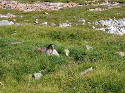
The keepers of the Alpine, the Marmots.
New cars? Nope. Kids? Nope. Soulmates who love the peace of the mountains? You betcha!
We had two options for our Sunday;
A. a steep pass to another hanging valley, and then the comfort of a true trail, all of which we had beta on.
Looking over to Option A and the headwall that would mark the beginning of a scramble towards the ACC hut.
Or, B. an exit out of the valley we were in. Down many clicks of bushwhacking and creek hatefulness & unknown adventure. Both options were about 25 kilometers, but Option B would be more straightforward, once we were out of the Alpine, or so I assumed. As my friend Jim likes to say, the topo map doesn’t show a 50 foot cliff…..
Option B it was, we stayed high in the pass and then started working our way down to the creek. Lot’s of awkward scrambling, sketchy creek crossings, loose talus slopes, steep nasty creek bottoms, a couple of 75 foot waterfalls that weren’t on the map.
Looking back on one interesting section that we successfully navigated.
A rare spotting of the skookum wild woman.
The famed Edith Cavel in prime climbing condition.
Our friend Raven.


No comments:
Post a Comment