Friday, October 31, 2008
Halloween Grip
Saturday, October 11, 2008
New Hecklers
Test riding the new rigs.


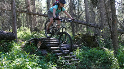
Today we went and rode the Holloween trail, nice little loop near Hinton. There were a few jumps and skinnies along the way. Between the bike park and the new steed, I had the confidence to enjoy a few stunts. Loving the new Hecklers!
Hitting the gap jump on the "Just Giver" trail.

Jolene on the Halloween Trail.

Monday, October 6, 2008
Location XXXX, Jasper National Park
We quickly donned our gaiters and bushwhacked up the creek, getting to the first lake around mid afternoon.
The lakes provided some interesting rock hopping that went on and on and on. Although not geographically far from the busy
Below: Looking back on the days progress.
Below: and ahead to tomorrow's goal, the pass
Our favorite lil' shelter, the BD First lite.
The next morning we were up early to establish our high camp. As we neared the Apex of the pass, the views were amazing. The biggest goat I’ve ever seen relaxed in the shade nearby. In the tarns there were the tracks of grizzly, caribou, deer, moose and numerous birds. We found a nice location for our camp, waiting until evening to pitch the tent. A bit of scrambling got us over to a nearby snow field where we did some boot skiing. Does this qualify for an August ski? I’m not sure.
The Alpine evening was wonderful. We tracked the neighborhood goat around the pass and were dazzled first by sunset, followed by alpenglow and shooting stars.
The next morning we were up at the crack of nine. After watching three Caribou water, we filtered our own.
Indian Paintbrush in full bloom.
Enticing moderate alpine climb. Note the beautiful splitter couloir!
The Ramparts towering above Amethyst lake. The peak to the right of the snow couloir is Oublette. Next right: Dungeon. On the far right Redoubt. All beautiful Alpine climbs on good rock. (Quartzite.)
Our last view of the Ramparts before the moderately hateful exit bushwack scrambley stuff.
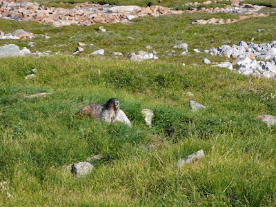
The keepers of the Alpine, the Marmots.
New cars? Nope. Kids? Nope. Soulmates who love the peace of the mountains? You betcha!
We had two options for our Sunday;
A. a steep pass to another hanging valley, and then the comfort of a true trail, all of which we had beta on.
Looking over to Option A and the headwall that would mark the beginning of a scramble towards the ACC hut.
Or, B. an exit out of the valley we were in. Down many clicks of bushwhacking and creek hatefulness & unknown adventure. Both options were about 25 kilometers, but Option B would be more straightforward, once we were out of the Alpine, or so I assumed. As my friend Jim likes to say, the topo map doesn’t show a 50 foot cliff…..
Option B it was, we stayed high in the pass and then started working our way down to the creek. Lot’s of awkward scrambling, sketchy creek crossings, loose talus slopes, steep nasty creek bottoms, a couple of 75 foot waterfalls that weren’t on the map.
Looking back on one interesting section that we successfully navigated.
A rare spotting of the skookum wild woman.
The famed Edith Cavel in prime climbing condition.
Our friend Raven.
Thursday, August 28, 2008
Jolene & Jacks Trail
Last night we just completed the budget build of her Santa Cruz Heckler. The bike will get burlier as she get's more brave, but it's great for now. Last week she tried her first trail feature and cleaned it. The look on her face is priceless, I think it means she's having fun...
Saturday, August 2, 2008
Bedson Ridge
I’ve had a tough time finding partners who wanted to climb in the traditional style this summer. When Terry phoned around
We arrived at the parking lot around
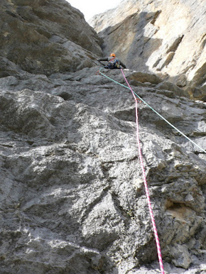
The climb follows the diagnol weakness in the middle of the face.
I made it to the first belay on one of our half ropes, and then brought Terry up. Consulting the topo, it looked like Terry would draw the crux of the climb, a few committing moves of 5.8 pitch that wound its way over a small roof.The climber would have the option of using either the funky off width or a smattering of small edges. We were surprised to see a bolt protecting the moves. It was a bit of a relief, as we weren’t looking for a ride this evening. Terry and I climb for fun, pure and simple. Terry cruised through the moves and on to easier ground and the belay. I threw the pack on and followed the pitch up to Terry. The next pitch was mine. I ended up combining almost of all pitches 3 & 4. The climbing was great! It was mostly gear protection with the occasional piton. The limestone at B-Major is quite textured and offers plenty of small positive edges. I found myself in my zone and really enjoyed the full 60 meters.
Terry then came up to me and started the next pitch. (Then end of pitch 4). He was off route for a moment, but then came back around. This induced quite a bit of rope drag, and we realized that I had nearly finished pitch 4 in my effort. To reduce drag, I climbed the quick 15 meters to Terry and set off again on lead. For me, the next pitch was the highlight of the climbing. There was sufficient protection around although the more moderate sections were a bit runout. I ended up taking us up another 55 meters (combining almost all of pitch’s 5 & 6), and it was beginning to look a bit dark. Terry came up quickly and complemented me on my lead. According to the topo, the next bulge would be the end of the technical climbing. It was then easy ground to top-out on the ridge proper. I’d let our nearly 59.5 meters of rope before I felt that Terry had me on belay. I finished quickly as the last light was fading. Thankfully I was able to call my wife and let her know we’d be a little late.
The pain in my feet told me that it was a mistake not to bring our shoes up. The darkness made me sorry that Terry had forgotten his head lamp. It was a long 3 hours through the trees and along the steep wavy slab. The first person would walk out about 5 feet and then turn around to light the way for the second.
With a lot of luck, we eventually found our pack. The approach tennies were a welcome relief from the rock shoes we’d been in for the last 8 hours. We were soon down to the railroad tracks. We were tired, and it was late on a new moons stormy night. We remained positive however, passing eerie signal lighting on the active line. We made it over the train tunnel and back to the truck sometime around
Yep, we epiced. But, we knew it was going to go be a late night with such a late start. The weather worked with us, and the climbing was moderate, so we knew what we were getting into before we even left the house. Terry and I had a great time, and it put a smile on our faces. Sometimes an epic adventure reminds me how good it is to be alive and well on this earth. It’s also nice to know that there is amazing multi pitch climbing just down the road from where I sleep at night!
Tuesday, July 22, 2008
Fryatt Valley Backpacking
With our late start, the first campground was to be our destination. Jo and I made up some pesto-cheese-pasta that was fantastic! We also had a bit of the fireball and snacked on some delicious organic dark chocolate. It was a perfect birthday!
Jolene slept so soundly that night! We both awoke in the morning full of energy. We packed up camp and headed to the headwall area and the ACC hut, about 10 km & 600 m from the lower campground. It was a beautiful day, and the going was easy.
After the big ski traverses of spring, early summer mountaineering, and plenty of sport climbing as of late, the relaxing pace of backpacking felt great.
This trip was something of a anniversary. On our first trip to Jasper, Jo and I did this same trip, and fell in love with the Canadian Rockies. It was this same trip that inspired our move to the Jasper area.
We made our way up above the headwall. After some 4th class terrain, we began to wonder if we were still on the trail to the hut. We weren't, but we quickly found the trail again.
Originally, our plan was to attempt to link up the Fryatt & Geraldine Valleys via a remote alpine pass. However, with our late start on day 1, this was not going to happen. We were quite content to enjoy a simple backpacking trip! We awoke Sunday morning and began the 22 km march back to civilization. It was great to have another backpacking trip with Jo!
Friday, June 20, 2008
Who's got the stove in the North Columbias?
G: Which stove did you bring B?
We setup the shelters on a nice little dry spot in an alpine meadow. Waking at
Time to regroup. Dana’s husband ended up bringing us a stove
At about
All of us were now at the anchor, 500’ below the summit. It was a tough decision, but in the end we decided to bail. None of us wanted to go for a ride in a ground slide that day.
We did get some top notch shovel glisse on the way down.
We packed up camp, and walked out in the rain. There is still over 6’ of snow in the mountains of the
Monday, June 2, 2008
Garibaldi Neve Traverse
Original objectives included the Wapta Traverse (on the B.C/Alberta border) as well as the Bugaboos to Rogers Pass Traverse but, discussion of remoting size 3 avalanches on slopes less than 30 degrees scared us further west. Thus we began consulting the bible of coastal BC ski mountaineering, "Exploring The Coast Mountains on Skis," by John Baldwin. After an epic amount of driving we finally found ourselves in the Diamond Head parking lot for Garibaldi Provincial Park in the Coast Range of British Columbia. We made it into the Elfin Lakes hut Thursday evening in a nice blizzard. Little did I know that poor/little visibility would be the theme of our trip.
Prior to this trip, I'd been on quite a few glaciers, but, always with partners that were more experienced than I. This marked the first time that I'd truly be responsible for decision making. To make things a little more interesting, we were skiing in a near whiteout. Skiing in a whiteout is a very disorienting experience akin to being inside of a ping pong ball. You have no perception of what is ahead of you, your inner-ear is mystified with regard to your current position, and the only way to Navigate is with a GPS (I've been using the Garmin eTrex legend for years and I love it's simplicity. Combine this with a good 1:50,000 scale map and you're in great shape!) Whiteout isn't too bad if you're out for a little slack country day trip, but when bobbing between seracs and crevasses, it's a bit un-nerving. (Photo: Jim Harris )
 We made it to a feature known as, "The Tent" and elected to call it a day here. This would put us in position for an attempt on Mt. Garibaldi the next morning. We busied ourselves with all the camp chores associated with sleeping in a GoLite Hex in the middle of an Icefield. (Stomping out a spot for the tarp, melting snow into water, cooking supper, etc.) We were tired and the sleep felt great.
We slept well and awoke early to more poor visibility:
 We quickly packed up our rucksacks and set off for Mt. Garibaldi via the NE face. We worked our way up to the bench just below the bergshrund. We'd been preforming various stability test during the ascent, and the information we were getting was not favorable. The upper 3 feet of the pack had been wind hammered into a slab that was strong in compression and weak in shear, the recipe for big hard slab avalanches. We elected not to ascend the peak, but lapped the lower 2/3 instead.
 After a few laps, it was time to go down to camp and pack up. We looked back on Garabaldi and our tracks had already been swept away by the wind!
As we dropped elevation, we got into some great breakable death crust skiing. Good stuff with the full mountaineering pack on. We got to Garibaldi lake safely, and then skated miles across the lake. Eventually we reached the Battleship islands and it was time to start dropping elevation back down to the nearest trail head. We got through some 3000 vert of sketchy iced out trail skiing without incident, and we were soon at the trail head.
 I told the driver my destination was Squamish and he was sure he could get me there.
At first I thought the car was a VW Beetle, but I was mistaken. It was a 2 cylinder Citroen of French make, imported from Japan, driven by a Slovenian ex-pat. The man behind the wheel was incredibly generous, driving me the full 45 km's to Squamish, and then an additional 30 minutes up the Diamond head road to my Jeep. I was very thankful!
Another hour of driving brought me back to Jim and the gear. We threw everything in the Jeep, gave each other a congratulatory hand shakes, and set off to Whistler to find a shower, beer & a non dehydrated meal. Before long we were planning our next objective, the Spearhead Traverse.


